Red route: following the new 1833km gas pipeline from China to Turkmenistan
Great JourneysJournal of a road trip through Central Asia
27 November 2015
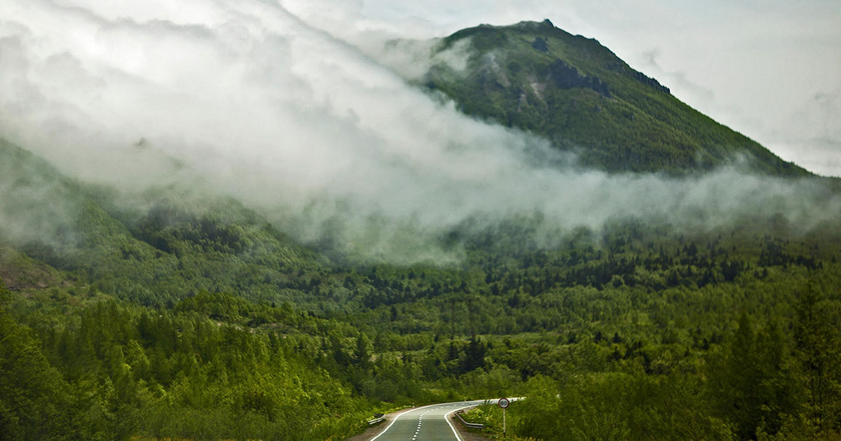
On the China-Kazakhstan border at Khorgos, we waited in line, uncertain whether we could continue onward. We tried to keep calm and observed the families who were crossing the border with us. The languages began to blur subtly from Uyghur into Kazakh. Mandarin had been fading from our world since we had left Urumqi and began the drive west for three days, following the Tianshan Mountains across the desert to the border.
Our route was determined by the 1833km-long Turkmenistan-China Gas Pipeline, which was completed in 2014 and which marks the most ambitious of China’s projects in the $16.3 billion Silk Road Strategy Fund. The previous day, we left a nondescript border town, Alashankou, where the pipeline entered China, the culmination of its journey across Central Asia. After clearing the Chinese border checkpoint at Khorgos and entering the intermediate zone between the two nations, we boarded a packed van, where townspeople were charging $15 a head to travel 1km to the other side.
After waiting anxiously in line, the gates to Kazakhstan opened. Crossing the border, we trailed behind families as they dragged rollaways and carried cardboard boxes of fruit and electronics. Having found a driver who was willing to give us a ride for a reasonable fare, we hopped into a tattered, dusty sedan and headed for Almaty. The Kazakh pop music booming from the car stereo felt ecstatic. The driver was in his 40s, lived in the border town and made trips to and from Almaty each day. The intense heat and the barren landscape conjured the American southwest. It was a vast desert, with craters and canyons that seemed infinite. We felt overwhelmingly dehydrated, baking in the bouncing car with the windows down. It was hallucinatory, like a mirage scene from Werner Herzog’s Fata Morgana.
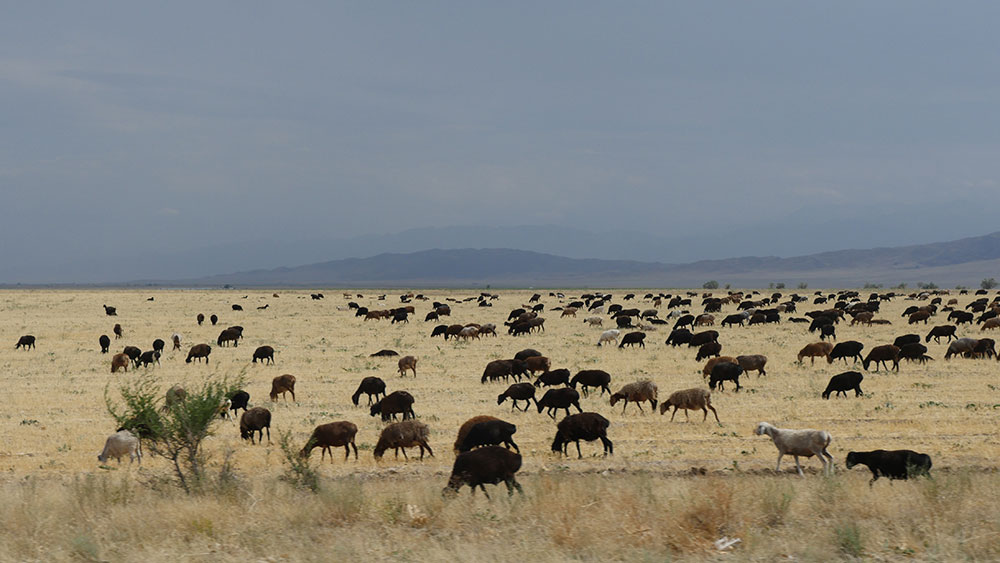
The sheep bleated and the cars honked, like a symphony celebrating the encounter of slow and fast, old and new, flexibility and rigidity
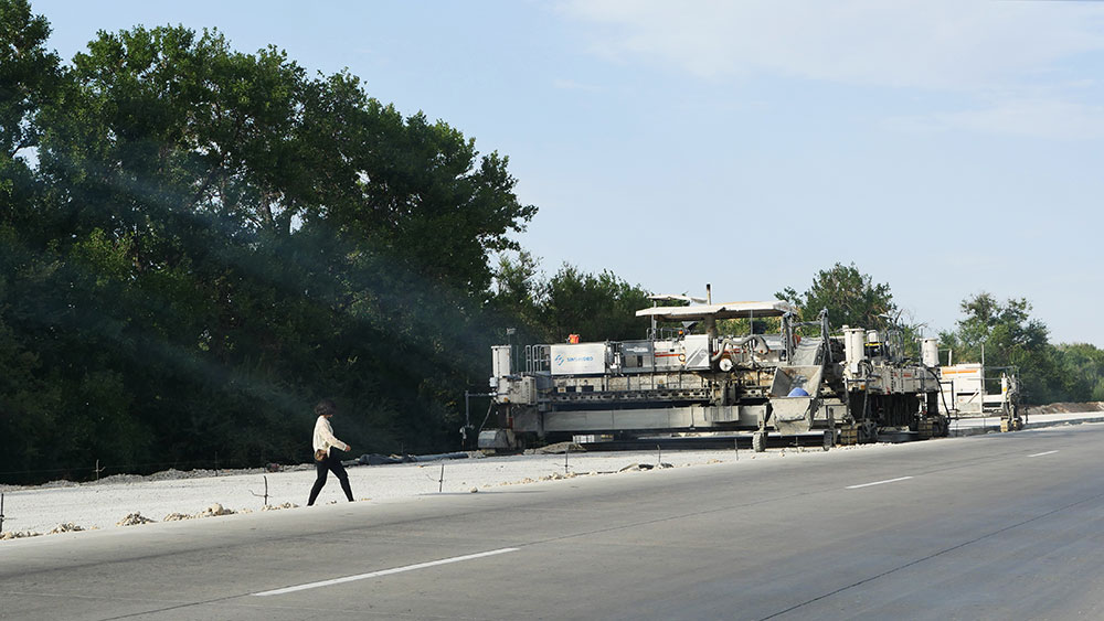
Our journey from Khorgos extended across the A2 Highway from China’s northwestern border to the point at which Kazakhstan gives way to Uzbekistan at Tashkent. About an hour’s drive west from the city of Almaty, we pulled over the car along the side of the road to film a vast flock of sheep grazing on a hillside. Unexpectedly, the flock started moving toward us, and just a few minutes later, 200 sheep started to cross the A2, right in front of our video camera. As the drivers blared their horns, the sheep bleated in outrage to declare their right to move freely through the landscape. The road not only connects but also separates the space it defines. It creates an obstacle, a barrier, for thousands of possible flows that not only run parallel to the road, but at times confront it directly.
We saw signs for cattle crossing, sheep crossing, and people crossing distributed along the A2. We saw above-ground bridges and all sorts of infrastructure recently completed and in-progress across the A2. The historic Silk Road was never a single route, but a larger network of various itineraries that crossed much of Eurasia. The A2, by contrast, is a fixed line. The traffic jam caused by these 200 sheep lasted for about five minutes. Just as we were about to leave the scene, the traffic returned to its usual flow, and the sheep that had just moved to the other side of the A2 turned their heads back to us and started to cross the road again in the opposite direction. Once again, the sheep bleated and the cars honked, like a symphony celebrating the encounter of slow and fast, old and new, flexibility and rigidity.
Who could blame a shipping corporation for not bothering to haul an empty container back to a port or railroad-shipping hub?
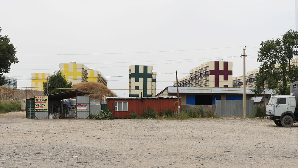
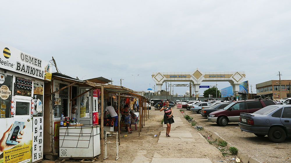
Along large stretches of the A2, the Kazakh landscape appears muted in color, dominated by brown fields, stone and dirt lots and overgrown (and under-watered) grassland. The character of this landscape, a sharp contrast from the lush fields outside of Almaty, was particularly dominant between Shymkent, Kazakhstan’s third-largest city, and the village of Zhibek Zholy, which sits on the border with Uzbekistan. Yet it is here that, with particular frequency, colour does appear from a most unexpected source: shipping containers. Throughout our journey, we were intrigued by the sheer quantity of shipping containers that were littered across the Kazakh countryside and skillfully inserted into even the densest of urban neighbourhoods. These unexpected monuments reference the enormous distance between Kazakhstan, the largest landlocked country in the world, and ports on international shipping routes. Who could blame a shipping corporation for not bothering to haul an empty container back to a port or railroad-shipping hub?
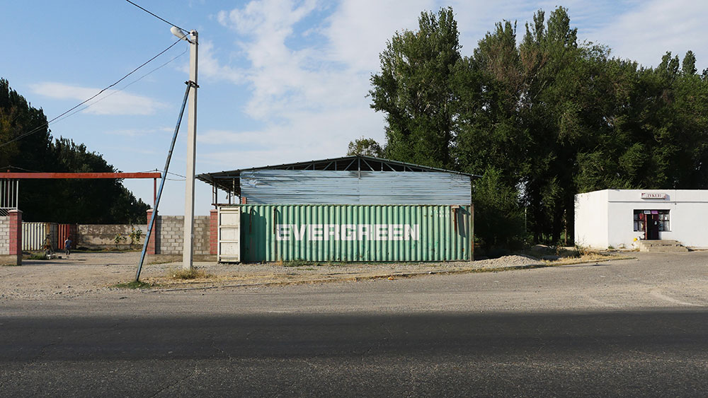
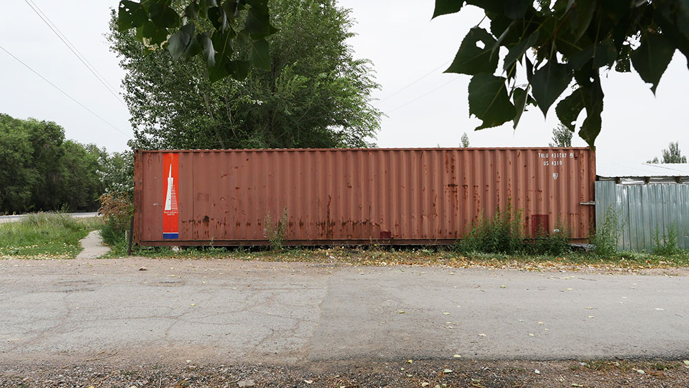
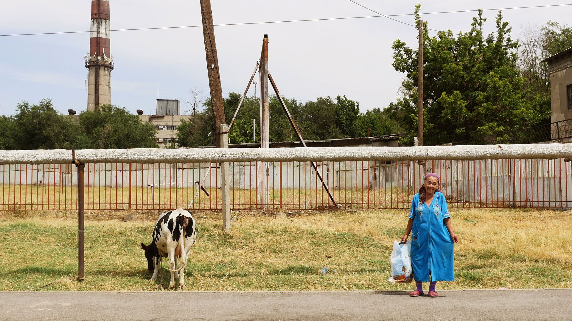
Whereas the majority of the containers sat idle along the roadside, others had been re-appropriated by locals to serve different functions. In the town of Shu, a bright blue-coloured container had been retrofitted into a small shop selling auto supplies with a sign for Valvoline, an American supplier of motor oil, prominently displayed on the container’s roof. On the road leading to Shymkent, while stopping for gas, we came across a small family that had fused three rectangular containers together to form a house flanked by what amounted to a small “backyard” littered with children’s toys. And in Merki, a town of 35,000 located midway between Almaty and Shymkent, a container served as a small stage, placed prominently outside the entrance to the city park and abutted by a small canopy.
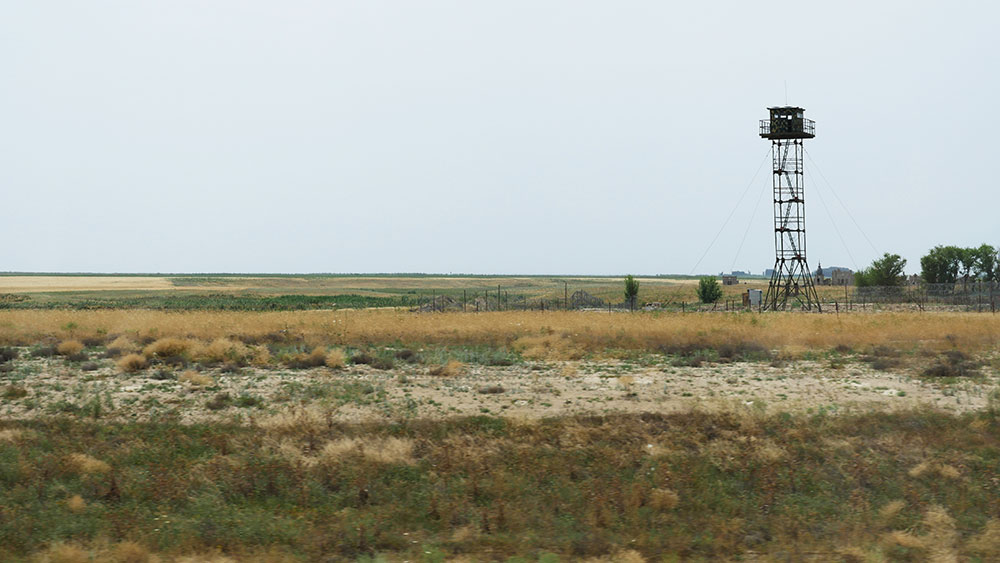
The A2 sector between Korday and Merki runs almost entirely parallel to the Kazakhstan-Kyrgyzstan border. The difference between the landscapes on either side of the border is very subtle. Nevertheless, the seemingly endless razor-edged fence and the countless watchtowers, painted in camouflage, were still strong indicators of two distinct territories, shaped and protected by the national border.
While the Turkmenistan–China gas pipeline has been rendered in news items and policy documents as a sign of an emerging borderless world, our hours of waiting to cross the Kazakhstan-China overland border in Khorgos, and our days of waiting for proper departure documents in Almaty, actually revealed the rigidity of political borders on the human scale. People and goods were two inseparable components of the historic Silk Road that covered a large territory lacking clearly demarcated borders on the ground. Caravans stopped at fortresses and oases along the way, passing their loads from trader to trader. In an era where each nation-state is a “bordered power-container,” in Anthony Giddens’ words, the pipelines have replaced humans and camels to form a highly efficient yet homogeneous trading route that overcomes political borders.
It was not so much the physical reality of the pipeline that intrigued us, but rather the linear landscape it transverses and the cultural space that it binds together
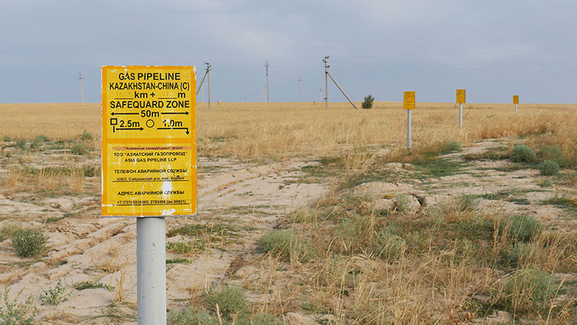
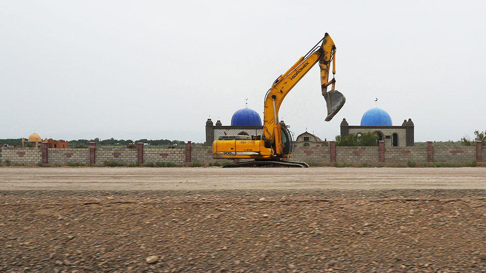
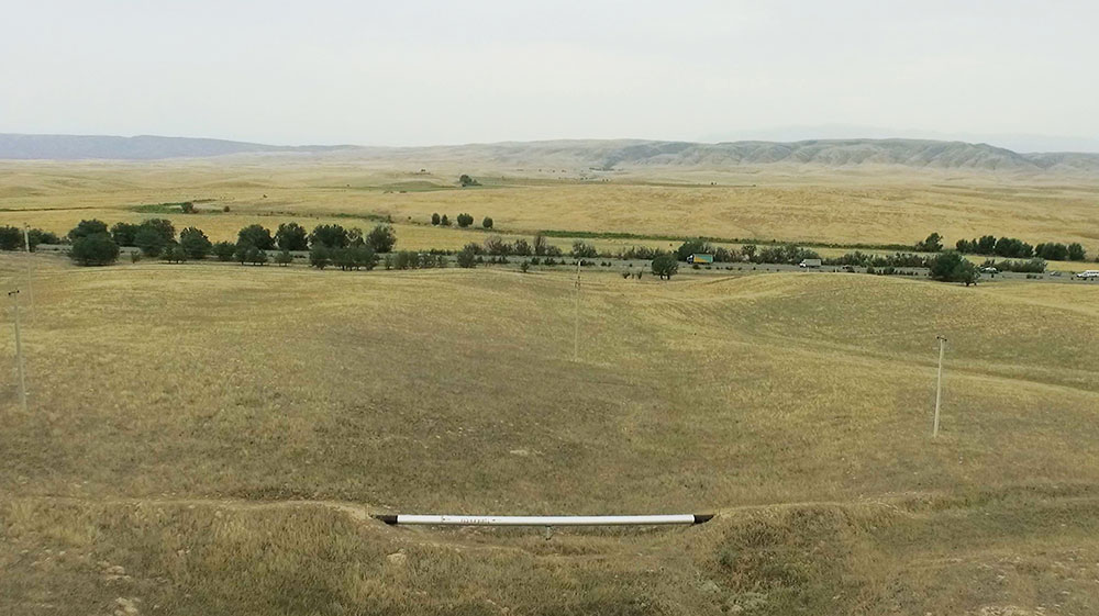
And what of the pipeline? After all, it was that which had brought us to central Kazakhstan in the first place. The vast majority of the Turkmenistan-China Gas Pipeline travels underground, beneath the vast Eurasian land bridge, revealing itself as it “comes up for air” less than a dozen times over the 1,050km we traveled. Even so, the linear landscape we documented is littered with markers indicating the existence of the pipeline below: yellow signs on slender metal posts that reveal the pipeline’s width and announce “Asia Gas Pipeline LLP” in small font; larger signs meant for automobiles with the simple message of “GAS” (ГАЗ) written in large block letters; and occasional roadside access platforms and other servicing hubs surrounded by flimsy chain link fences. But it was not so much the physical reality of the pipeline that intrigued us, but rather the linear landscape it transverses and the cultural space that it binds together: the statues, houses, people, gas stations, containers and countless other encounters on our journey along the A2.